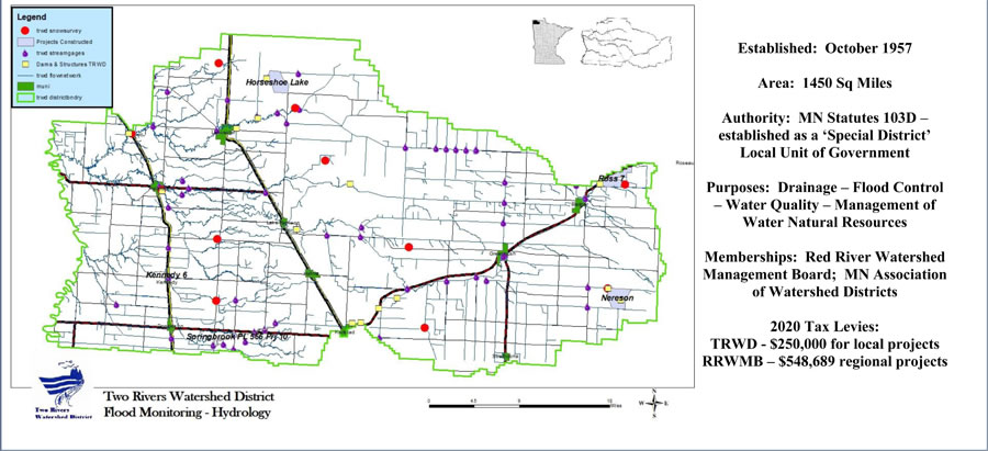
- ➢Ross Impoundment - Provides 3,600 acre feet of storage from 18.2 square miles
- ➢ Nereson Impoundment – Provides 3,500 acre feet of storage from 16 square miles
- ➢ Horseshoe Lake – Provides 2,130 acre feet of storage Over 9,200 Acre Feet of Storage (1 acre foot = 325,829 gallons)
- ➢ Ring Dikes - Constructed 24 farmstead ring dikes
- ➢ Flood Reports – Provide daily water level & flood news & updates to local-state-federal agencies and the media
- ➢ Survey – Mapping – Elevation Data - Provide Survey Grade GPS and LiDar data and interpretation of predicted flood crests to farmsteads and other points on the ground to aid in sandbag dike construction
- ➢ EMERGENCY Declarations – MN Statute 103D.615 enables the Board of Managers to declare an emergency if there is a clear and imminent danger. This enables the District to undertake emergency work relative to flooding to protect life and property.
· http://www.nws.noaa.gov/floodsafety/
· http://www.dnr.state.mn.us/waters/csg/index.html
· http://waterdata.usgs.gov/mn/nwis/rt
· https://water.weather.gov/ahps2/index.php?wfo=FGF