Horseshoe Lake
About Horseshoe Lake
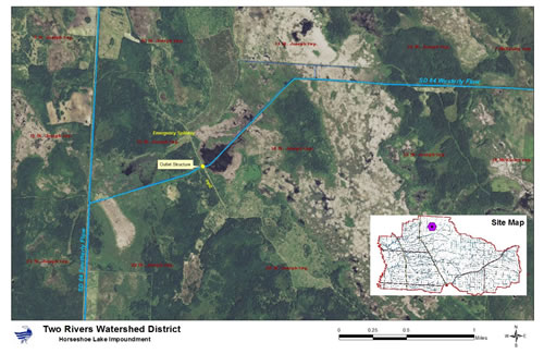
The original wildlife structure, located north and east of the City of Lancaster in the SW ¼, section 15, T163N, R47W, was installed in 1968 under the Federal PL-566 program and is referred to as the Horseshoe Lake Wildlife Structure. The project consisted of diking, an emergency spillway, and a 54" diameter x 68' long pipe with an 8' x 16' x 7' concrete box inlet associated with the main outlet, and also a north dike to contain flows from State Ditch #84. Engineering and technical assistance was provided by the Natural Resources Conservation Service (previously known as the Soil Conservation Service) and funding and other resources were provided by both the Minnesota DNR (previously known as the Department of Conservation) and the Two Rivers Watershed District.
This structure was constructed for the purpose of waterfowl production, and it was envisioned that a 351 acre impoundment with an average 2' depth would be created at the normal pool elevation of 974.2 feet. A flood pool of 590 acres would occur at an elevation of 977.1 feet.
The impoundment did not attain its expected wildlife or flood control benefits, and in 2007 the DNR, TRWD, and Kittson County agreed to modify the structure by cutting a 4'x6' notch in the face of the cement box and inserting stoplogs to be able to manipulate the water levels. The new project has a capacity of storing a total of 2,130 acre feet from a drainage area of 29.4 square miles. This has local benefits to the North Branch Two Rivers and also smaller benefits to the Red River.
For a printable copy of the assessment area map, click here.
Photo Gallery
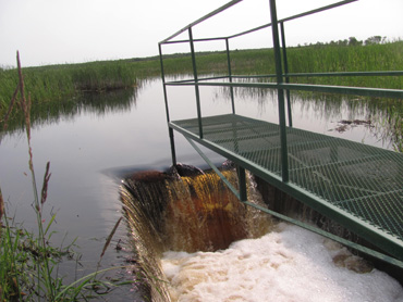
The Horseshoe Lake outlet structure has an operable stop log bay to regulate water levels
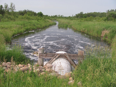
The Horseshoe Lake outlet flows westward into Skull Lake
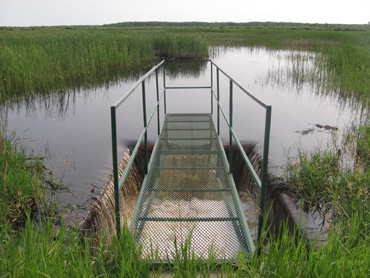
Horseshoe Lake at its maximum capacity